wellness
Bogotá's Best Walking Trails Rated by Distance and Difficulty: Your Complete Guide
From a flat 2-kilometre lakeside loop to a lung-burning climb above 3,000 metres, the capital's outdoor circuits offer something for every fitness level.
How we reported this
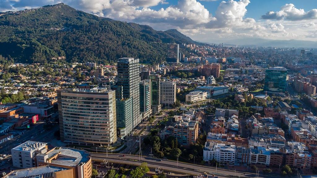
Bogotá has more green walking space per resident than almost any other major Latin American capital, and the city's network of senderos and ciclovías is busier than ever. On any given Sunday morning along the Ciclovía corridor, the 127-kilometre car-free route that snakes through the city from Usaquén in the north to Kennedy in the south, tens of thousands of residents are already out before 8 a.m., on foot or on wheels. The question now is which trail to choose once you step off the main circuit and into something more demanding.
Bogotá sits at 2,600 metres above sea level. That baseline altitude shapes every walk here. A route that would feel moderate in Medellín or Cartagena can leave a sea-level visitor gasping on the first uphill stretch. That context matters, and it is why more walkers are turning to rated trail guides rather than simply following Google Maps into the cerros.
Three Trails, Three Difficulty Levels
For beginners or those managing cardiovascular conditions, the Parque Simón Bolívar lake loop in the Teusaquillo locality is the standard starting point. The circuit around the park's main lagoon measures approximately 3.5 kilometres on flat, paved paths and has zero significant elevation gain. Entry is free every day of the week. The park's own signage marks the distance at regular intervals, making it easy to track progress without a fitness watch. Most walkers complete it in 40 to 50 minutes. On weekends, the Instituto Distrital de Recreación y Deporte, the city agency that manages Bogotá's public parks, stations wellness monitors near the main gate who can check blood pressure for free.
For intermediate walkers, the Quebrada La Vieja trail in the Chapinero Alto neighbourhood is the city's benchmark mid-level route. The sendero climbs from Calle 72A eastward into the Cerros Orientales, gaining roughly 350 metres of elevation over a 5-kilometre round trip. The path is unpaved after the first 500 metres and passes through native forest managed by the Empresa de Acueducto de Bogotá, which co-administers the watershed. Weekend mornings bring steady foot traffic; weekday slots before 10 a.m. are quieter. Hikers typically finish in 90 minutes to two hours. Sturdy trainers are sufficient; dedicated hiking boots are not required but help on the rocky upper sections. The trail is free to enter and closes at 4 p.m. daily.
Experienced walkers with solid altitude acclimatisation should look at the Sendero Caminando los Cerros route toward Monserrate's northern ridge, which reaches just above 3,150 metres at its highest viewpoint. This 8-kilometre round trip from the Funicular base station in La Candelaria demands roughly 650 metres of cumulative elevation gain and takes between two and a half and three and a half hours. The Empresa de Telecomunicaciones de Bogotá has posted directional markers along the upper path. Walkers who prefer a shorter ascent can ride the Teleférico de Monserrate, a single cable-car ticket costs approximately COP 26,000 as of mid-2026, and walk only the ridge section.
What the Numbers Tell You
Bogotá's Encuesta de Calidad de Vida 2024 found that roughly 38 percent of adult residents reported walking as their primary form of physical activity, higher than cycling at 12 percent and gym attendance at 9 percent. Demand for structured outdoor routes has grown alongside renewed interest in hormonal and metabolic health, a global conversation that Colombian physicians and endocrinologists have been tracking closely, particularly regarding the cardiovascular benefits of sustained aerobic exercise at altitude. Anyone managing thyroid conditions, blood pressure, or hormonal therapies should consult a Bogotá-based physician before tackling routes above 3,000 metres.
The practical advice is simple: match your route to your current fitness, not your ambitions. Start with Simón Bolívar for three or four sessions, then graduate to Quebrada La Vieja once you can complete the lake loop without stopping. Give yourself at least two weeks at city altitude before attempting Monserrate on foot. Carry at least one litre of water regardless of distance, the thin, dry Andean air dehydrates faster than most walkers expect. And check the Instituto Distrital de Recreación y Deporte's website before heading out: seasonal rain in July can make unpaved upper trails slick and occasionally closes access before midday.